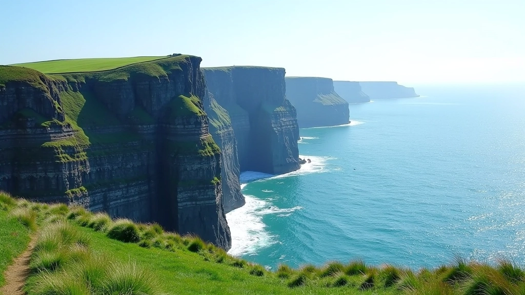

Understanding Wicklow's Mountain Terrain
Wicklow's mountains aren't like the Alps. They're rounded, heathery, and surprisingly dramatic when you're in the middle of them. The terrain shifts quickly — you'll go from wooded valleys to open moorland in just a few hours. That's what makes these routes so special. Plus, the weather changes constantly, which means you get different views depending on the day.
The key thing about Wicklow hiking is that difficulty isn't just about distance. It's about elevation gain, terrain surface, and weather exposure. A 10-kilometer walk on a paved path is completely different from a 10-kilometer walk on loose scree. We've organized the routes below by what you'll actually experience, not just mileage.
What to Pack for Wicklow Mountains
- Waterproof jacket (it's essential, not optional)
- Proper hiking boots with ankle support
- Layers — mornings are cold even in summer
- 2+ liters of water and snacks
- Map and compass (phone GPS fails in mountains)
- Sunscreen and hat
Beginner Routes: Valley Walks and Forest Trails
If you're new to hiking or prefer a relaxed pace, Wicklow's valley trails won't disappoint. These routes follow streams, wind through coniferous forests, and rarely venture above 400 meters. They're also well-maintained, which means solid footing and clear paths.
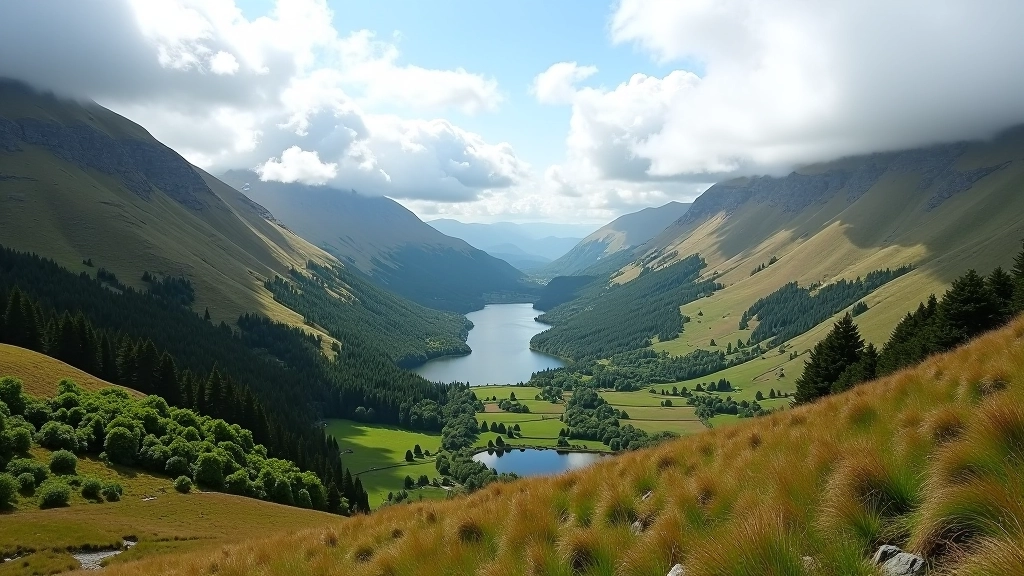
Glendalough Valley Loop (9km, 2-3 hours)
This is probably the most popular beginner route in Wicklow. You'll start at the monastic site (which is worth exploring), then loop around the lower valley with the mountains towering above you. The path is mostly flat and follows a stream. It's beautiful without being strenuous. Most people do this walk, take a break at the valley bottom, and feel genuinely accomplished. Honestly, it's one of the best introductions to Wicklow hiking you'll find.
The route takes you past two lakes — Upper and Lower Glendalough. The lower lake is where most visitors go, but if you continue to the upper lake, you'll see fewer people and get better views of the valley walls. The entire loop is on established paths with good drainage.
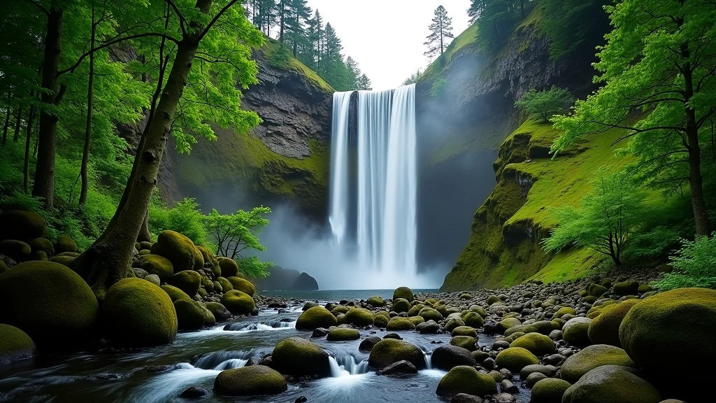
Powerscourt Waterfall Loop (7.5km, 2 hours)
If you want a shorter walk with a dramatic payoff, this is it. The trail climbs gradually through woodland to Ireland's highest waterfall. The whole route feels like you're walking through a fairy tale — moss-covered trees, a babbling stream, and that waterfall appearing through the trees as a surprise.
What makes this different from Glendalough is the focus. You're not wandering a valley — you're hiking toward a specific destination. The return is slightly downhill, which feels good on your legs. Most hikers complete this in about 2 hours with a 15-minute stop at the waterfall itself.
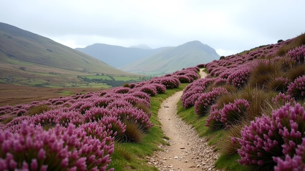
Intermediate Routes: Ridge Walks and Open Moorland
Ready for something more challenging? Intermediate routes take you above the tree line onto open moorland with views that stretch for kilometers. You'll gain 400-600 meters of elevation, and the terrain changes — some rocky sections, some grassy paths. These walks require decent fitness and proper footwear, but they're not technically difficult.
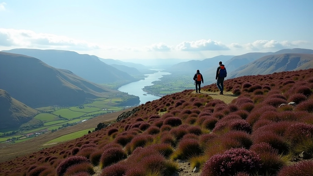
Table Mountain and Djouce (11km, 4 hours)
This route climbs from Crone Valley onto a high ridge with incredible panoramic views. You'll see Dublin on clear days — that's how high you are. The walk goes up Table Mountain first (the name's accurate), then traverses to Djouce Mountain. Both summits are relatively bare, which means full exposure to weather. Don't underestimate this one — the elevation gain is spread over the full distance, but it's relentless.
The terrain is mixed. You'll walk through heather, cross boggy sections (hence the waterproof boots), and navigate some rocky scrambles. Nothing technical, but you need to watch your footing. Weather changes fast up here. We've seen hikers start in sunshine and reach the summit in fog. It happens. That's why the views are so good when you get them.
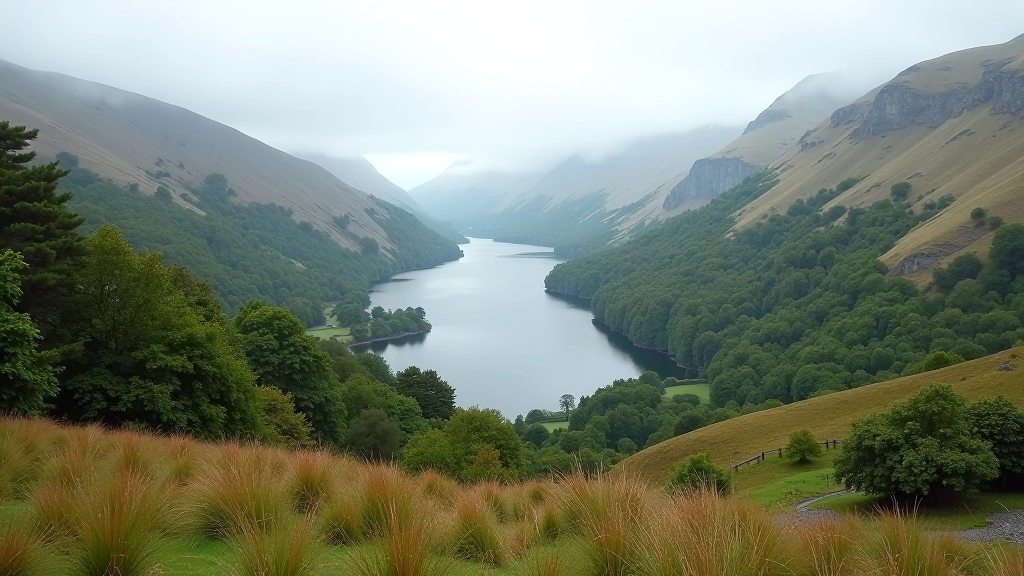
Luggala Lake Circuit (10km, 3.5 hours)
This route combines lake views with mountain climbing. You'll start at Luggala estate, climb through forestry plantations, then emerge onto open moorland with views of the lake far below. The circuit returns along a forest track. It's scenic without being brutally steep — the climbing is steady but manageable.
What we like about this walk is the variety. You get forest, moorland, lake views, and mountain vistas. It's not just repetitive hillside. Plus, the final section on the forest track is almost meditative — quiet, shaded, and easier on your knees than descent on rocks.
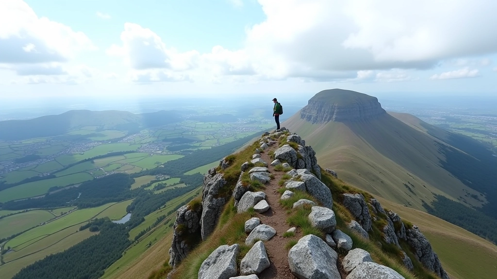
Advanced Routes: High Peaks and Technical Terrain
Advanced routes demand real fitness, navigation skills, and experience in mountains. You're looking at 800+ meters of elevation gain, exposed ridges, rocky terrain, and sections where a wrong step matters. These aren't rock climbing routes, but they require confidence on steep ground.
Advanced Hiker Essentials
Before tackling advanced routes, you should be comfortable navigating with map and compass, moving quickly on rocky terrain, and handling exposure (heights that feel genuinely high). Mobile reception is unreliable, so you can't rely on GPS alone. Consider doing intermediate routes multiple times before progressing here.
Mullaghcleevaun Traverse (14km, 5-6 hours)
This is one of Wicklow's serious walks. You'll climb to Mullaghcleevaun (925m), the highest peak in the range, then traverse a ridge system with multiple summits. The elevation gain is over 1000 meters. The terrain is rocky and exposed in sections. Bad weather up here is genuinely dangerous — wind can be strong enough to affect your balance, and visibility can drop to meters.
The payoff? Views that stretch to the Irish Sea on clear days. You'll see the entire Wicklow massif from above. It's worth every steep section and loose rock. But don't do this lightly. Check weather forecasts carefully. Don't attempt it in mist or wind. Bring proper navigation equipment.
Seasonal Considerations and Route Adjustments
Wicklow mountains change dramatically between seasons. Summer (June-August) brings long daylight but midges in boggy areas and more crowded trails. Spring and autumn offer the best weather and fewer people. Winter? That's when routes become genuinely serious. Snow and ice transform easy walks into dangerous terrain.
Here's the practical bit: in winter, add 2-3 hours to route times. Daylight ends at 4pm. Paths become slippery. Stream crossings are swollen. Most people skip the high peaks in winter unless they've got winter mountaineering experience. Summer routes that you'd walk in 4 hours might take 6 in winter.
Getting Started: First Steps
Start Small
Do Glendalough or Powerscourt first. Both are beautiful, well-marked, and genuinely doable for anyone with basic fitness. You'll learn how your body responds to hills without overcommitting.
Get Proper Gear
Hiking boots matter. You need ankle support and grip. Cotton socks are a mistake — get wool or synthetic. A waterproof jacket isn't optional in Ireland. It'll rain.
Go With Others
Your first mountain walks should be with someone experienced or in a group. You'll learn route-finding, pace management, and how to read the landscape. Plus, it's more fun.
Build Gradually
Don't jump from Glendalough to Mullaghcleevaun. Do the intermediate routes multiple times. Get comfortable on exposed terrain. Learn to navigate without marked paths.
Final Thoughts on Wicklow Mountain Hiking
Wicklow's mountains reward preparation and respect. They're not dangerous if you're sensible, but they'll punish overconfidence. The best approach is to start with routes that genuinely interest you, not routes that impress people. A beginner who loves Glendalough and does it multiple times will enjoy hiking more than someone who forces themselves onto advanced peaks before they're ready.
The routes we've covered here represent a genuine progression. Do them in order. Take time between each level. Pay attention to weather. Invest in decent boots. And most importantly — get out there. Wicklow's mountains are waiting.